SimGDMS provides geospatial data discovery, database management, & data translation for Modeling and Simulation (M&S) applications.
SimGDMS BrochureBenefits
Improved workflow management and data translation for simulation based geospatial data
SimGDMS is a powerful client/server framework for improved knowledge management and workflow for unique geospatial data and attribution used in a simulation context.

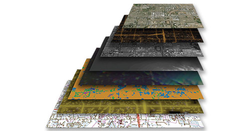

Advanced Light Extraction And Prediction (LEAP) capability
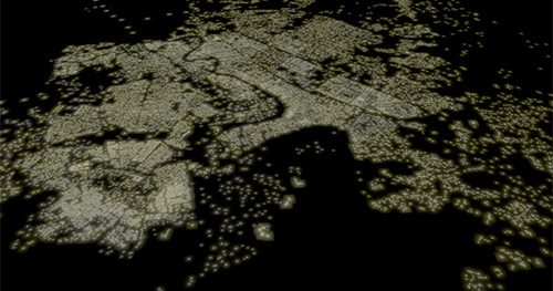
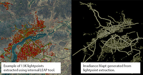
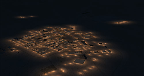
SimGDMS includes the capability to procedurally generate physically accurate cultural lighting based on your existing vector data to generate light points and lightmaps for your visual and sensor simulations.
Collaborative data management and publishing
SimGDMS enables multiple users in a workgroup to cooperatively ingest, attribute, catalog, sort, retrieve, track and publish geospecific datasets for downstream compilation to real-time formats and simulation applications.

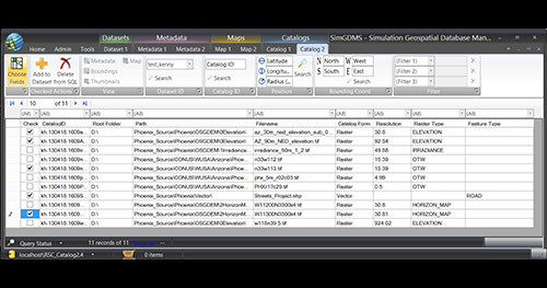

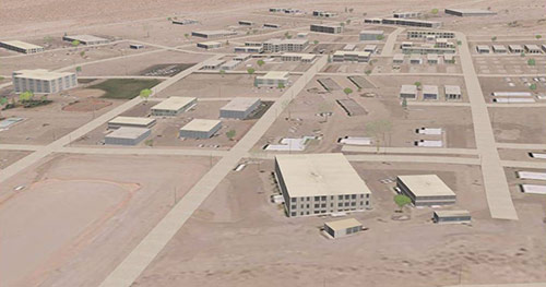
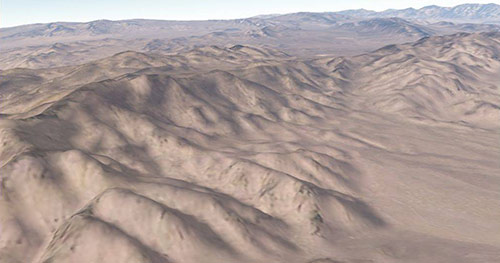
Real-time 2D & 3D preview of geospecific source data
Advanced metadata technology enables rapid native 2D & 3D preview as well as automated 3D compilation for certain RSC and 3rd party runtime products.
Why Choose SimGDMS?
SimGDMS was designed by M&S professionals specifically for the management and translation of the unique data sources and attributes utilized in the M&S domain.
SimGDMS Workflow
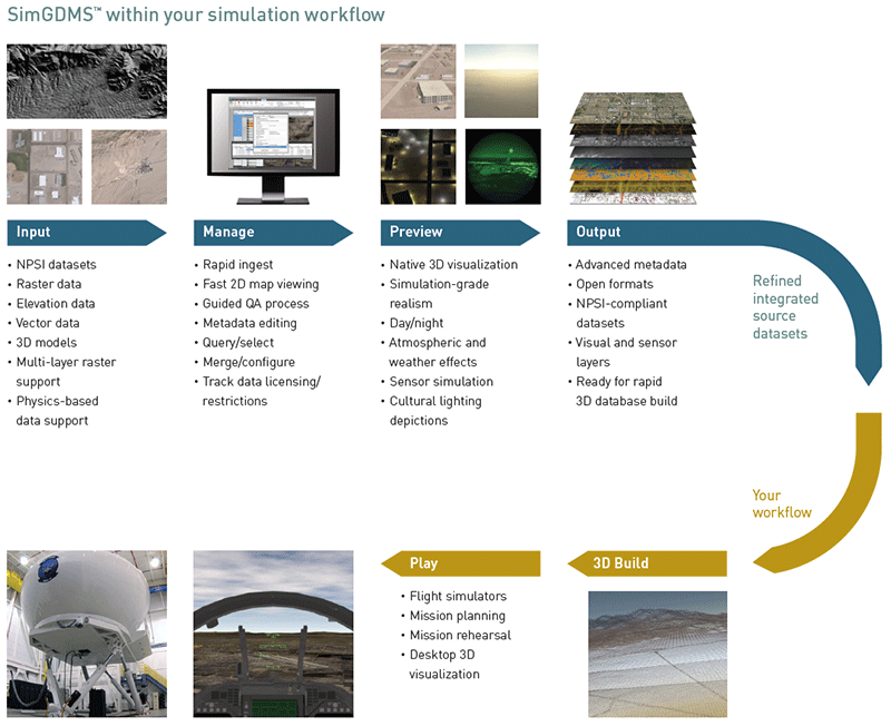
SimGDMS provides a full end-to-end solution for managing and translating multiple M&S data sources in a variety of formats and data standards to maximize the productivity of your simulation data and database development.
Product Details
SimGDMS is a client/server software system specifically designed to manage refined source data assets within visual and sensor simulation production pipelines. SimGDMS creates a framework for improved knowledge management and workflow involving massive worldwide geospatial data in a simulation context. Supporting a diverse set of traditional and physics-based data types. SimGDMS enables multiple users in a workgroup to cooperatively ingest, attribute, catalog, sort, retrieve, track commercial licensing and government handling caveats, and ultimately publish geo-specific visual data layers for downstream compilation to real-time simulation formats. Advanced metadata technology enables rapid native 3D preview as well as automated 3D compilation for certain RSC and 3rd party runtime products.
SimGDMS has a user-friendly desktop interface to provide centralized archival and discovery of valuable geospatial source data assets across your organization. Geospatial metadata files are rapidly ingested into SimGDMS and stored in an SQL server for efficient viewing, querying, and further processing. Ingested data files can be merged or added to create new datasets for further processing or easily published to other formats or dataset standards, such as NPSI, GoogleEarth KMZ, DS4 database, etc. A 3D viewer, HDSkyView, is included with SimGDMS as a companion viewer application to load DS4 flyable datasets for rapid 3D preview.
SimGDMS also includes a powerful tool to automatically predict cultural lighting positions, orientation, and luminaire properties for the generation of light-points and irradiance maps for advanced night simulations. The LEAPtool utilizes the geospatial data ingested into SimGDMS to create realistic and accurate light points and maps by combining the geospatial data with municipal rules and regulations for lighting placement, luminaire properties, and physics-based cultural lighting simulation algorithms. The LEAPtool generates a Light System Map shapefile that contains the lighting properties and placement of each light system in the specified geographic area as well as an Irradiance Map with physics-based quantified data in irradiance units. The resulting data enhances visual and sensor simulation rendering by providing relevant and accurate spectral domain information for each unique light point.